What is a Coastal Video Monitoring system?

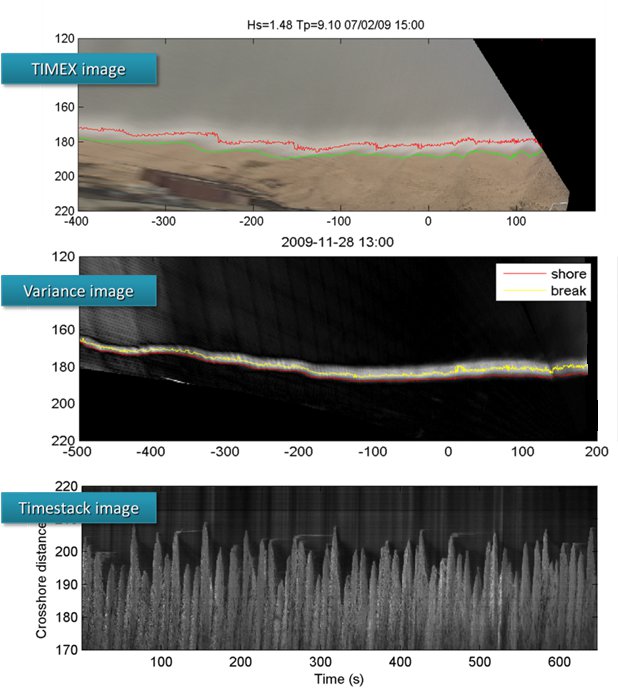
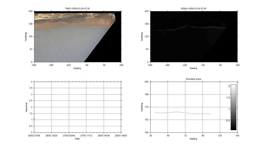
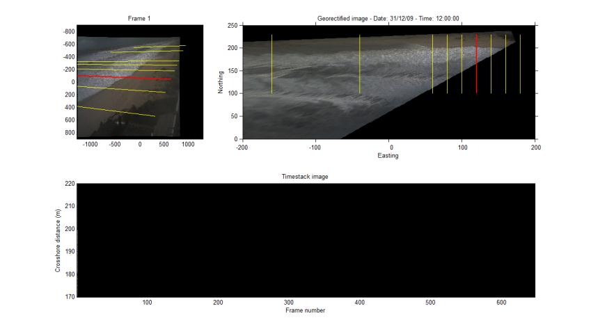
A Coastal Video Monitoring system typically consists of one or more video cameras, connected to a computer acquiring coastal imagery 10 min every hour during daylight, with an acquisition frequency of 1-4 Hz. Images are processed to generate the system's 'basic products'. i.e. time-averaged, variance, snapshot and timestack images, which are all projected in geographic coordinates using standard photogrammetric techniques. Following, a set of post-processing tools allows monitoring the intertidal topography, nearshore bar and shoreline position, as well as swash motions, on a daily basis.

Basic products

Images are processed to generate the system's 'basic products'. i.e. time-averaged, variance, snapshot and timstack images.

Lens distortion/Camera geometries

From top to bottom and left to right: Example of undistorted image, pixel footprint, x and y geographic coordinates shown on the original image

Shoreline extraction

One of the most important steps of the system is the automatic shoreline extraction. The algorithms used combine colour segmentation, on the timex images, and pixel intensities criteria, on the variance images. They are under constant development and improvement, processing thousands of images produced on a daily basis by the system and being constantly optimized to respond to all the possible conditions in the study area.

Watch video

Intertidal topography mapping

The automatically extracted maximum swash and breaking lines are leveled by applying numerical models and  known formulations, using real time wave and tidal measurements. Each line leaves a stamp and with the moving tide topographic impression of  the intertidal area is possbile.

Watch video

The system is running real time, and for each tidal cycle produces a set of leveled points providing information in the intertidal topography. The above information is used to update a Digital Elevation Model of the intertidal topography. The DEM is also updated from regular field surveys which also serve for validation and updating of other-than-intertidal sections.

Wave run up measurements

Timestack images are generated by sampling pixel intensities along an image transect. Horizontal axis expresses time and vertical distance and the time series extraction is becoming an image segmentation problem. See the video explaining the principle and click here to download my GUI application to process timestack images.

Beach user tracking

The system can be used to track the location of beach users and identify areas of high concentration, assisting among others (i) lifeguard operations in real time, (ii) coastal planners to identify the hot spots along the beach.

For more information

OSU Coastal Imaging Lab - The website of the group that started all.

COASTVIEW - The COASTVIEW project website.

CoastalWIKI - Coastal Wiki website about the Argus system.

Mermaid - The Mermaid project website.

USGS - An older USGS video monitoring website.