 |
 |
|---|---|
 |
 |
Previous research
Few words about my main previous research activities
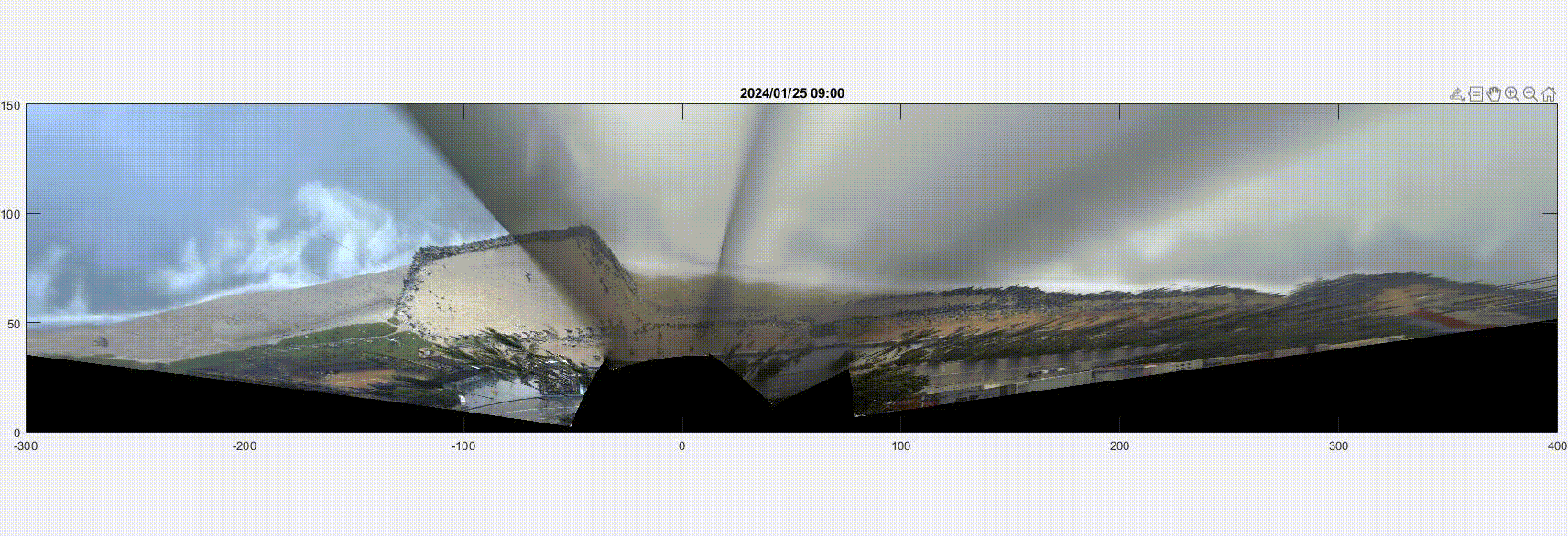
- Coastal video monitoring
- Physical modelling in the Large German Wave Flume
- The MICORE project
- Beachrocks
- Hydrodynamic measurements using optical techniques
- Airbone video methods
- Sediment dynamics in the Bay of Marseille
Contact info:
CEO
MV Coastal and Climate Research LTDLimassol, Cyprus
Email: vousdoukas@gmail.com
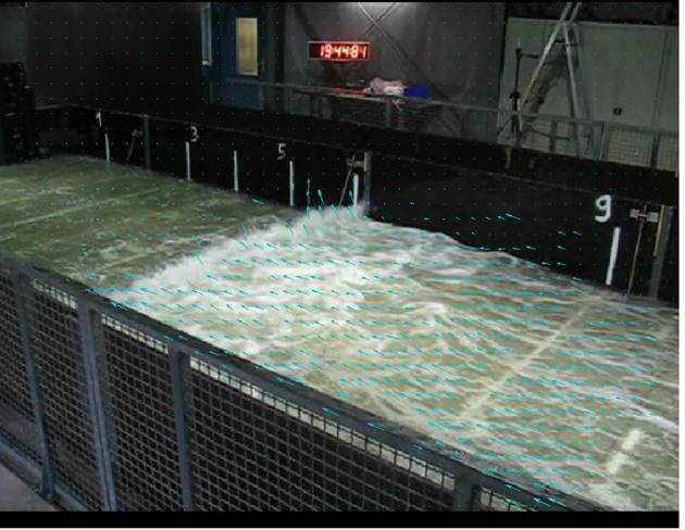
During 2011-2013 and while working at the Large German Wave Flume in Hannover, Germany, I gained extensive experience in physical modeling.
PISCES: Protocols and InStrumentation for Combined hydraulic and Ecological modelS (Joint Research Activities, within the FP7 European Commission Funded Collaborative Research Project; October 2010-October 2014).
WISE: Water-Interface-Sediment Experiments (Joint Research Activities, within the FP7 European Commission Funded Collaborative Research Project; October 2010-October 2014).
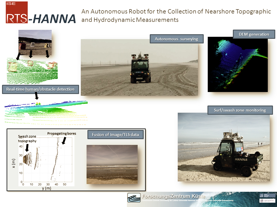
Beach topographic and hydrodynamic measurements are essential for coastal geology and engineering studies as well as sustainable coastal management. Standard approaches involve either time-consuming manual data acquisition usually with limited coverage or remote sensing techniques which are usually characterized by low resolution or increased costs. In collaboration with the Real Time System department of the Leibniz University of Hannover we tried to show the capabilities of the autonomous robot RTS-Hanna with a calibrated sensor setup including 3D laser range scanners, a camera, a Differential GPS and an inertial measurement unit which significantly facilitates field data collection. RTS-Hanna was tested at the Wadden Sea Barrier Island Langeoog, Northern Germany, for two days and was proven capable of autonomously collecting topographic scans. 175 GB of dense topographic and water surface elevation data were collected, including RBG images, while RTS-Hanna covered a total of 21 km of coastline in approximately 3 hours. Scans of the surf/swash zone allowed continuous measurements of topographic changes at the beachface, wave propagation velocities and wave breaking heights.
For further information see: Wübbold, F., Vousdoukas, M.I., Hentschel, M., B., W., 2012. Towards Autonomous Coastal Monitoring using 3D Laser Range Scanners and Camera Vision, 33rd International Conference on Coastal Engineering, Santander, Spain.
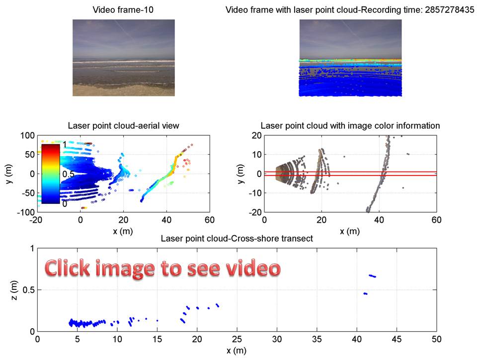
The following image is showing an example of the Laser point cloud, combined with the video camera images. Real time 2D scanning of waves is possible, while the fusion with the images provides color information for the point cloud. Click on the image to see an animation.
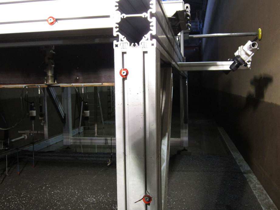
Different projects, development of measuring techniques and analysis of diverse data. Recently developed techniques incorporated in the facility's measuring capabilities:
PIV meaurements of flow velocities in the swash zone: The swash is characterized by a lot of features and as a result PIV works fine without the need of seeding to track motion.
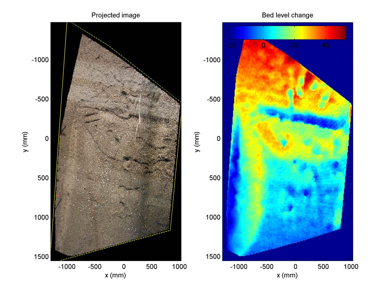
Stereo visio to generate 3D surface models of the bed: Stereo can be a very accurate and cost effective approach to measure 3D surfaces (of sediment but also water) and in LGWF there are available different stereo systems for static and dynamic measurements which have been applied successfully in different projects
The MICORE project
The general aim of the project was to develop and demonstrate on-line tools for reliable predictions of the morphological impact of marine storm events in support of civil protection mitigation strategies. The project was specifically targeted to contribute to the development of a probabilistic mapping of the morphological impact of marine storms and to the production of early warning and information systems to support long-term disaster reduction.
Monitoring of nine selected case-study sites was taking place to collect new data sets of bathymetry and topography using state-of-the-arts technology (Lidar, ARGUS, Radar, DGPS). The impact of the storms on living and non-living resources was be assessed using low-cost portable GIS methods and undertaking post-damage assessments. The regional coastlines were selected according to wave exposure, tidal regime and socio-economical pressures. They included outmost regions of the European Union at the border with surrounding states (e.g. the area of the Gibraltar Strait, the Baltic and Black Sea).
Numerical Models of storm-induced morphological changes were tested and developed, using commercial packages and developing a new open-source morphological model XBeach. The models were linked to wave and surge forecasting models to set-up a real-time warning system and to implement its usage within Civil Protection agencies. The most important end product will be the production of risk indicators with defined threshold for the identification of major morphological changes and flooding associated vulnerability. Finally, the results of the project were disseminated as risk maps through an effective Web_GIS system.
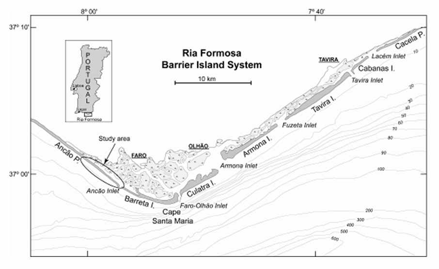
University of Algarve was one of the basic partners in the project and responsible for Work Package 1 related to the review of historical storms that had a significant morphological impact on a representative number of sensitive European coastal stretches.
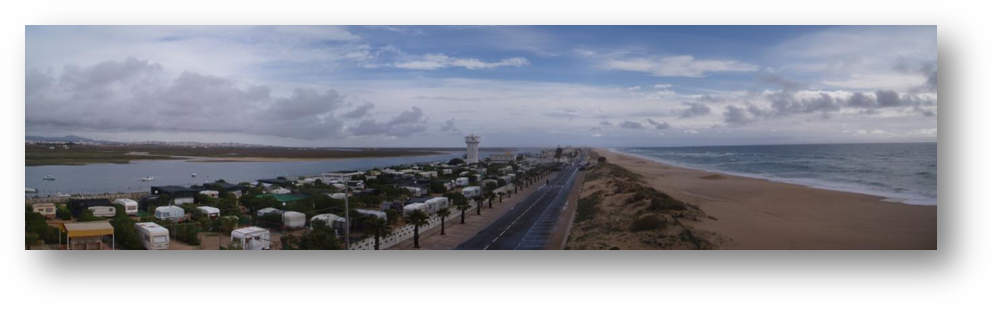
Praia de Faro was the Portuguese study site for the current project, located in the Southern Portuguese coast. The study site is a mesotidal (tidal range ~3 m) reflective beach with very dynamic morphodynamic behavior. Significant wave heights up to 5 m during storm events are being recorded on an annual basis and the erosion are recovery rates have been shown to be very fast.
While extensive information exists so far on the morphological evolution, the sedimentology and the hydrodynamics on the area our field efforts were more focused on the monitoring of storm events. Pre- and post storm topographic/bathymetric surveys were a crucial component. In the meantime hydrodynamic measurements (waves and tides) were being collected real-time, which coupled with the Automated video system working on the beach, followed the rapid morphodynamic processes on the study area.
All the topographic and hydrodynamic data were used for calibration/validation of XBeach, preparing a robust and tested tool for the assessment of morphological storm impacts and incorporate it in the final forecasting/early warning system.
See paper about the effect of storm groups on beach erosion and recovery.
See paper about the XBeach calibration and development of an EWS for storm hazard mitigation.
See paper about coastal vulnerability assessment combining Orasis imagery run up measurements and other field data.
See paper on beach cusp dynamics, based on Orasis observations and intensive field monitoring.
See study n historical stormminess in Portugal.
See study on thresholds for storm impacts on an exposed sandy coastal area in southern Portugal.
Beachrocks
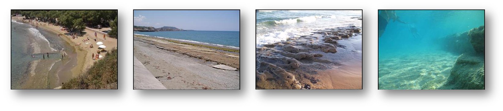
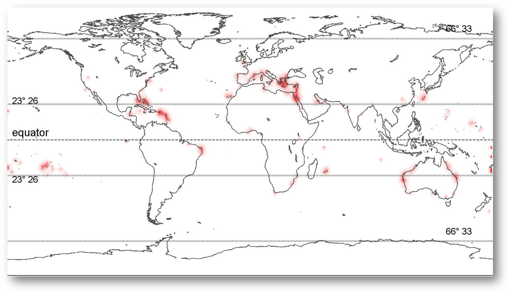
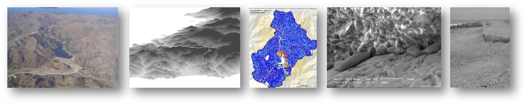
Beachrocks are hard coastal sedimentary formations consisting of various beach sediments, lithified through the precipitation of (mainly) carbonate cements. The formation of beachrocks has been attributed to carbonate precipitation from: (a) coastal sea waters and/or sea wave sprays; (b) sea/fresh water mixing in coastal aquifers which reduces CaCO3 solubility; (c) carbonate-saturated groundwaters; d) coastal water tables, due to CO2 de-gassing; and (e) coastal waters, due to biological activity. Beachrock formation is a global and diachronic phenomenon and (b) the great majority of beachrocks are found in tropical/subtropical and low temperate latitude, microtidal coasts (see following figure).
My PhD thesis aimed to collate/review information on the reported occurrences, characteristics and formation mechanisms of beachrocks and consider their impacts on the coastal zone. Apart from the literature review the study consisted of numerical modelling of beach profile evolution under beachrock presence, as well as field monitoring of infected areas.
While the efforts were mostly focussed on beach morphodynamics, there were also interesting results related to the implications on nearshore ecology, as well as the socio-economical impacts. The main outcome was a review paper on beachrocks. The results from the field study as well as the socio-economic impacts have been also separately published.
The presence of beachrocks has been found to affect significantly the beach morphodynamics by: (i) ‘locking’ the beach profile; (ii) modifying the nearshore hydrodynamics; (iii) changing the porous character of the beach and, thus, its response to swash forcing; and (iv) differential bed erosion at the margins of the beachrock outcrops that can alter significantly the long- and, particularly, the cross-shore sediment transport. Therefore, although relict submerged beachrock outcrops can provide some coastal protection by reducing the wave energy impinging to the coastline, modern beachrocks may promote offshore losses of unconsolidated beach sediments and buried beachrock outcropping. Finally, the presence of beachrocks may have also ecological and socio-economic impacts, as (a) the indigenous (mobile substrate) fauna/flora of the beach is replaced by hard substrate benthic assemblages and (b) beachrocks can diminish beach aesthetics and cut down its recreational uses and, thus, affect negatively its recreational/touristic potential.
Video applications (from the ground...)
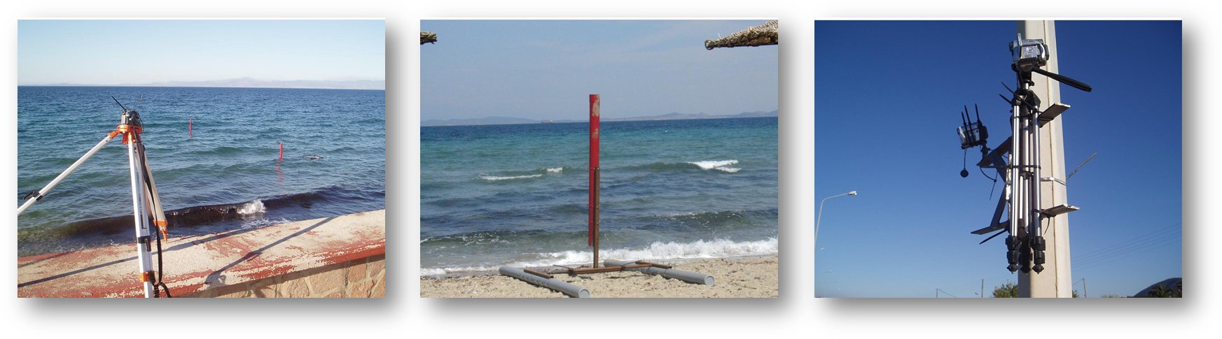
After the completion of my PhD I have spent significant time in high frequency nearshore hydrodynamic measurements using video methods. The aim was to develop video processing tools to conduct wave and run-up height measurements from imagery obtained from off-the-self video cameras. To my big surprise, what initially started as a hobby, just to keep me busy before my next post-doc, opened in from of me an interesting research domain, followed by several efforts, few publications and a passion that still goes on and brought me to the greatest challenge: To develop my own Automatic video monitoring system.
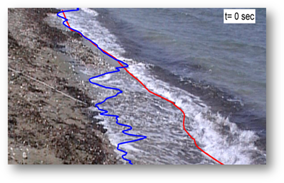
Some of the of highlights are the first dataset of wave run-up heights from the Mediterranean area, compared with known parameterisations, as well as a study of ship generated waves and their impacts. The wave swash tracking is taking place on the grounds of a motion detection method and some examples of the results are shown in the image and the video below.
Water level time series are obtained by a 'digital version' of the photopoles application, tested in the 80s by the US Army Corps of Engineers. The video technique proved to be an efficient, low cost alternative to sensors, which could be used by developing countries, as well as in cases in which dense measuring points are required or the risk of loosing the equipment is very high. For an example of the performance of the method see the video below.
Video applications (... from the sky...)
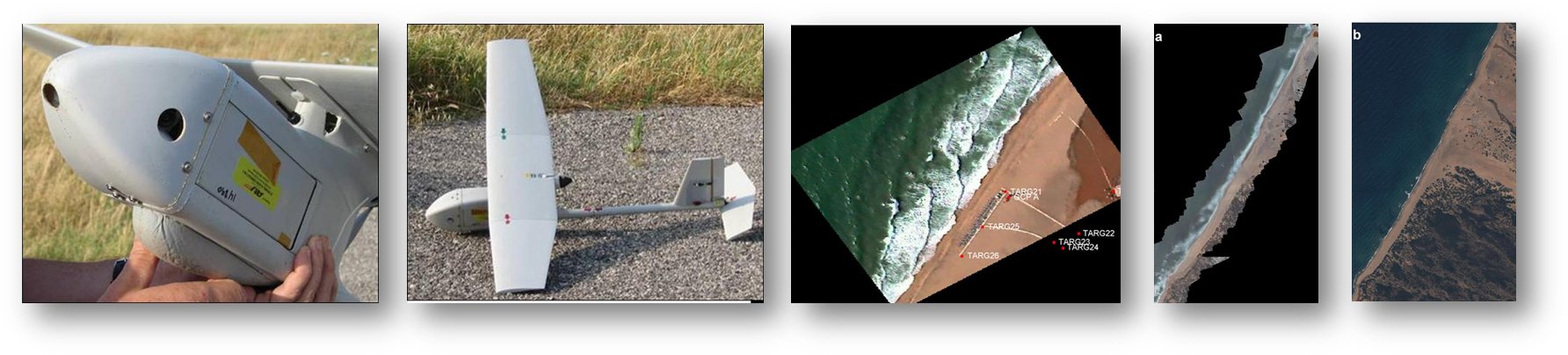
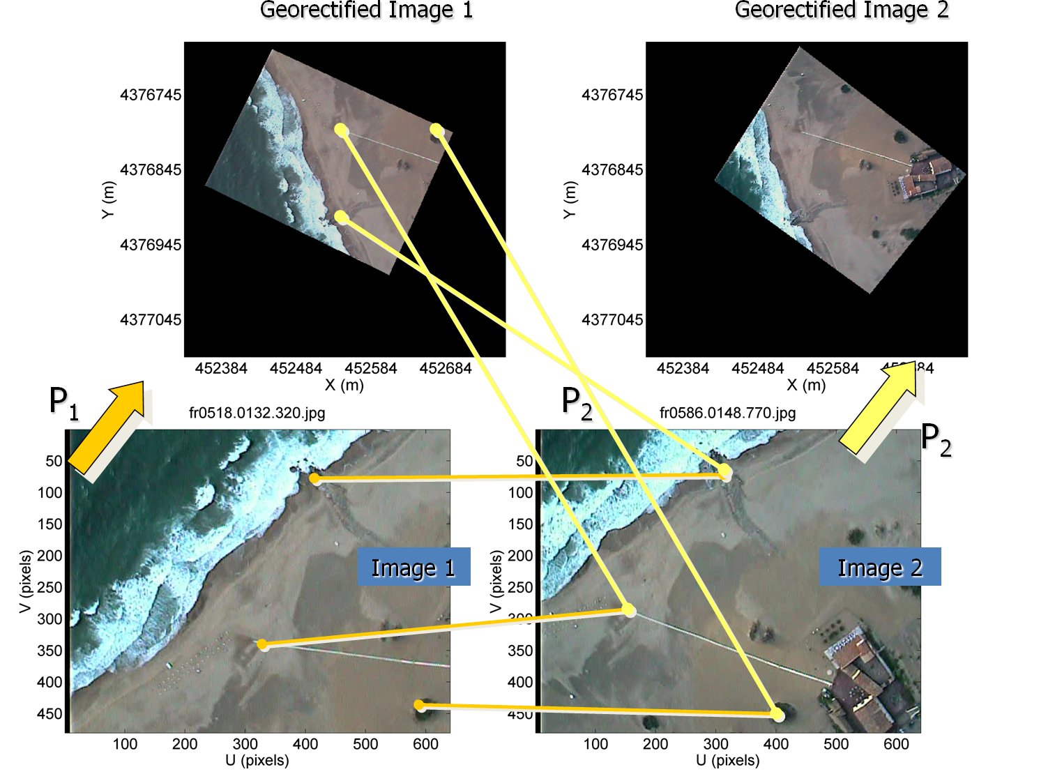
The next step brought me to the NATO Underwater Research Center in La Spezia, Italy, where I participated to the Airborne Forward Eyes Program, with Dr Daniel C. Conley as supervisor and Pr. Rob Holman from Oregon State University participating. The idea was to produce some of the results of the ARGUS system but from moving platform, using Small Unmanned Autonomous Vehicles (SUAVs). The most difficult task on the project was the georectification of the imagery as the obtained meta-data were not accurate enough. Towards that purpose a semi-automatic procedure was developed to project each image automatically, on the grounds of common features (keypoints) with the previous one, identified by a specialised algorithm. The method proved robust and only the first image needed to me manually georectified (see below an example video.
Sediment dynamics in the Bay of Marseille
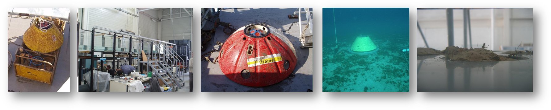
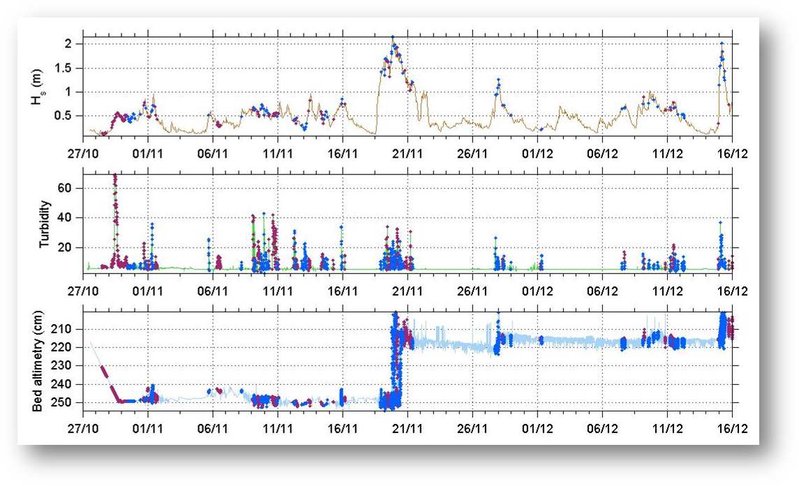
My project for IFREMER was focusing on a study of the fate of sediments in the Bay of Marseille, taking place under the METROC project, which aimed to assess the origin and fate of pollutants in the area. Fine sediments are the main pollutants carriers and for that reasons their dynamics have been studied using various approaches like a) in-situ data collection, by autonomous benthic stations (see figures below) deployed for periods of few months, field campaigns on a weekly basis and bed sediment sampling for characterisation and erodibility tests with real cores b) satellite images and c) hydrodynamic and sediment transport modelling. More than 60 sampling stations were investigated to provide a clear overview of the main characteristics of surface sediments, i.e. grain size measurements, water content, concentration, carbonates and organic matter content.
The strategy of the project was a) to assess the bed erodibility/sediment mobility; b) obtain ground truth point data at specific positions from the frame stations deployments and c) on using these information as reference to obtain information on sediment dynamics from the whole area using specifically calibrated/validated numerical models.
 |
|
Other projects
 Apart from the above I have been involved in several other
studies and consultancies mostly for the Department of Marine
Sciences in the University of the Aegean. Some of the topics are
the implications of dams on the coast, beach cliffing, beach
nourishment, etc. For more info see my CV
section.
Apart from the above I have been involved in several other
studies and consultancies mostly for the Department of Marine
Sciences in the University of the Aegean. Some of the topics are
the implications of dams on the coast, beach cliffing, beach
nourishment, etc. For more info see my CV
section.